Looking at ranches in Irion County can feel exciting and a little overwhelming. You want solid ground under your boots, dependable water, and a clear plan for how the land will work for your goals. This guide gives you a practical, on-the-ground checklist you can use during a showing, plus the follow-up steps that protect your purchase.
You’ll learn what to bring, how to spot red flags, which records to request, and how to structure next steps after a tour. The tips are tailored to Irion County’s semi-arid landscape and rural services so you can make confident, informed decisions. Let’s dive in.
Timing matters in Irion County
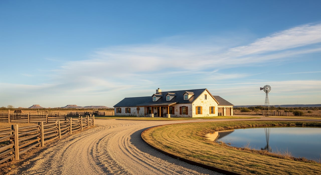
Irion County sits in rural West-Central Texas with rolling plains, mesas, native grasses, and brush like mesquite. Rainfall is seasonal, so what you see depends on when you visit. Wet periods reveal vegetation, springs, and tank levels. Dry spells expose well performance, stressed forage, and how tanks hold water.
If possible, visit in both wet and dry parts of the year or ask the seller for photos and records from different seasons. This gives you a truer picture of water reliability, grazing capacity, and access conditions.
Before you tour: get ready
A little prep pays off in the field. Gather key documents and pack the right gear so your time on-site is efficient and thorough.
Documents to request
- Current deed and legal description
- Recent survey or plat with easements and rights of way
- Title commitment and property tax records
- Mineral rights statement and any current production
- Well records and water quality tests
- Copies of any leases: grazing, hunting, or oil and gas
- Utility and pipeline maps and recorded easements
- Seasonal aerial imagery if available
- Any environmental reports or known issues
What to bring
- Reliable vehicle, often 4WD for ranch roads
- GPS or smartphone with offline topo maps and, if available, a boundary file
- Camera or phone for photos, plus binoculars
- Tape measure or laser rangefinder and flagging tape
- Small soil probe or digging tool
- Field notebook, pen, and copies of the survey and deed
- Water, hat, sun protection, sturdy boots, first-aid kit
Questions to ask upfront
- How is legal access provided: deeded road, recorded easement, county road, or private road?
- Are there active leases? What are the terms and expiration dates?
- Are minerals owned or severed? Any active or likely oil and gas activity?
- Age and service records for wells, tanks, and pumps
- Any boundary disputes, fence agreements, or unrecorded access arrangements?
- Recent fire, flood, or other significant events on the property?
On-site checklist: what to evaluate
Use this checklist to guide your showing. Cross-check observations with the survey, deed, and other records you requested.
Access and road conditions
- Type of access: Confirm deeded access or recorded easement. Note any gates and whether you have a legal right to operate and rekey.
- Road condition: Paved, gravel, or two-track. Is it impassable after rain? Check who maintains the road per easement or county records.
- Emergency access: Estimate time to hospital, volunteer fire department, and sheriff support. Note cell coverage limitations for safety and communications.
Boundaries and fencing
- Fence presence and condition: Walk or drive lines where possible. Look for broken or missing stretches.
- Fence type: Barbed wire, woven wire, high-tensile, or cross fencing. Consider whether it fits your intended use.
- Corners and monuments: Locate survey markers or iron rods. If corners are unclear or lines seem off, plan for a new survey.
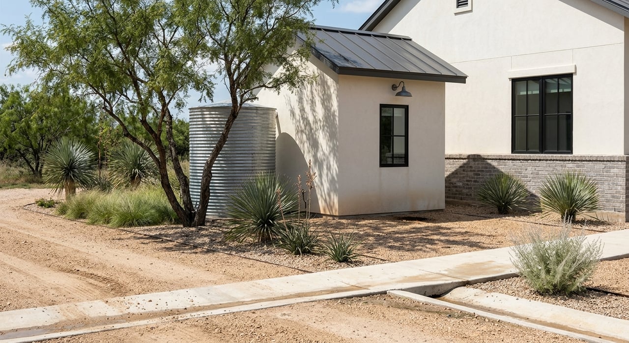
Water: wells, tanks, and quality
- Surface water: Inspect stock tanks, springs, and intermittent streams. Look at dam integrity, spillways, and water marks to gauge recent levels.
- Wells: Find the well head and note casing condition. Ask for pump test results, depth, static water level, and last service date. Pump capacity in gallons per minute is essential for home, livestock, or irrigation planning.
- Quality and rights: Request lab results for bacteria, nitrates, TDS, salinity, and common metals. Ask if any surface water permits or impoundment approvals apply. Texas follows the rule of capture for groundwater, and some areas have Groundwater Conservation District rules, so confirm what applies locally.
- Infrastructure: Inspect storage tanks, pipelines, float switches, and pressure systems. Note maintenance needs.
Utilities and communications
- Electric: Identify the nearest meter or pole and the likely provider. Estimate distance and likely cost to extend service.
- Gas and propane: Look for existing tanks and service arrangements.
- Septic and wastewater: Locate tank lids and drain field areas if present. Ask for permit records and age.
- Internet and cell: Test service on-site. Many rural areas rely on fixed wireless or satellite.
- Improvements: Check barns, pens, windmills, solar arrays, and other structures for condition and functionality.
Grazing, forage, and soil
- Vegetation: Identify dominant grasses and brush. Carrying capacity is seasonal and variable, so plan for swings in rainfall.
- Soil depth and fertility: Probe for topsoil depth and rockiness. Note if you should take samples later for lab testing.
- Water distribution: Count water points per pasture and whether cross fencing supports rotational grazing.
- Brush and erosion: Mesquite and woody encroachment can reduce forage. Note gullies, rill erosion, and compaction.
Terrain, build sites, and hazards
- Topography and drainage: Mark ridges, draws, and natural building pads. Think through driveway and utility runs.
- Flood risk: Low-lying draws can flood in storms even if maps do not show it. Ask for FEMA and county floodplain information.
- Septic and foundations: Soil and perc testing may be required to confirm suitability for septic and building.
- Fire risk: Note fuel loads, spacing around structures, and options for defensible space.
Wildlife, hunting, and recreation
- Habitat and signs: Look for cover types, game trails, rubs, and signs of feral hog activity.
- Existing setups: Inspect blinds, feeders, and food plots. Confirm quality and whether any lease terms affect use.
- Sensitive habitat: Ask about any endangered species concerns that could limit development or require permits.
Red flags to watch during a showing
- No recorded legal access or unclear easements
- Deed acreage that does not match visible boundaries
- Severed minerals with active or likely oil and gas activity
- Missing well records or low, seasonal well yield for your planned use
- Old or failing septic with unknown drain field location
- Heavy brush encroachment that will be expensive to control
- Unknown or uninsurable easements across key building or grazing areas
- Flooding, erosion, or soil stability concerns that appear repeated or unaddressed
After the tour: due diligence steps
Budget time and money for follow-up tests and records. Build these into your offer timelines so you can verify the essentials.
Surveys and title
- Boundary survey: If no recent survey exists, order an ALTA or boundary survey to confirm corners, lines, and easements.
- Title commitment: Verify ownership, liens, easements, and access. Have a professional review mineral reservations and conveyance history.
Water and septic testing
- Well tests: Order a pump test for gallons per minute, static water level, and a lab panel for bacteria, nitrates, TDS, salinity, and common metals.
- Septic suitability: Arrange soil borings or perc tests where needed.
- Groundwater and permits: Confirm whether a Groundwater Conservation District applies and ask about any surface water or impoundment permitting.
Environmental and utilities
- Environmental screening: Consider a Phase I environmental assessment if you see signs of fuel tanks, chemical storage, or older industrial use.
- Oil and gas: Identify any pipeline easements, well pads, and production records that could impact use.
- Service feasibility: Get cost estimates to extend electric, and check county requirements for building, new roads, or access changes.
Leases, ag programs, and records
- Leases: Get copies of all active grazing, hunting, and oil and gas leases. Verify termination or assignment provisions.
- Ag and soils: Review NRCS soil survey data and any FSA or conservation program enrollments that may carry restrictions.
- Appraisal and inspections: Consider livestock infrastructure inspections, fencing contractor estimates, and an appraisal if needed for financing.
How your agent helps protect your interests
A good rural agent coordinates documents, schedules access, and keeps your due diligence moving. You can expect help obtaining deeds, surveys, tax records, well logs, and lease copies, then organizing them for you and your chosen professionals.
Your agent also connects you with trusted local surveyors, title companies, well drillers, pump testers, soil and septic professionals, fencing contractors, and county contacts. They help request title commitments, flag easement or access issues, and coordinate pump tests, perc tests, and environmental screenings.
Contract timelines matter in rural deals. Your agent should help structure contingencies for survey, water and septic tests, title review, and financing so deadlines match the realities of ranch property testing. For complex title or mineral issues, plan to consult a Texas-licensed attorney.
Ready to tour Irion County ranches?
If a ranch in Irion County is on your radar, use this checklist to guide your first showing and your follow-up plan. Focus on access, water, utilities, boundaries, and seasonal realities. Then back up your observations with surveys, tests, and records so you can buy with confidence.
When you are ready, reach out to a local, responsive partner who understands West Texas land and how to coordinate a low-stress process. Connect with Roy Zesch to plan a smart, thorough tour.
FAQs
What should I bring to a ranch showing in Irion County?
- Bring 4WD if possible, offline maps with the boundary file, a camera, binoculars, tape measure, flagging tape, a small soil probe, copies of the deed and survey, water, sun protection, sturdy boots, and a first-aid kit.
How do I verify legal access on a rural Texas ranch?
- Match what you see on the ground to the deed and survey, confirm a deeded road or recorded easement, review maintenance responsibilities, and resolve any locked gate or unrecorded access concerns before moving forward.
Which well tests should I order before buying acreage?
- Order a pump test for gallons per minute, static water level, and seasonal performance, plus a water quality panel covering bacteria, nitrates, TDS, salinity, and common metals, and collect the well log if available.
How do brush and soils affect grazing potential in West Texas?
- Heavy mesquite or woody encroachment reduces forage and may require costly control, while shallow or rocky soils limit carrying capacity; use NRCS data and on-site checks to plan stocking and improvements.
Who coordinates surveys and inspections during a land purchase?
- Your agent typically organizes access, connects you with surveyors and testers, schedules inspections, and helps set contract timelines for survey, water and septic tests, title review, and financing.